
Currently Browsing
Posts Tagged ‘ geography ’
10 Fun Facts for Geography Awareness Week
- 13 November //
- Posted in For Parents, Fun Facts, Teaching Resources //
- Tags : geography, social studies
- Comments Off on 10 Fun Facts for Geography Awareness Week
November 11-15 2024 is Geography Awareness Week.
Geography is an integral part of any Social Studies class. Making connections between a region’s geographic features and its history and culture can broaden students’ understanding of history. Some facts about geography will not only add flavor to a social studies unit but will also wow the students with unexpected answers and fun visuals.
Did you know…
#1. The smallest country in the world is Vatican City at only 0.2 square miles. The headquarters of the Catholic Church is located entirely in the city of Rome. Vatican City isn’t just the smallest country in land area, it is also the smallest country by population. Only about 600 people live there permanently, almost all of whom are clergy or members of the Swiss Guard, responsible for protecting the Pope.
#2. Unsurprisingly, the largest country in the world is Russia. What you may not know is Russia, with an area of 6,592,735 square miles, is almost twice the size of the second largest country in the world Canada, which comes in at 3,855,081 square miles. Over 60% of the land in Russia is forest, while over 4000 miles of the nation is tundra.
#3. Brazil is 11% larger than the contiguous 48 states of the United States of America. As a matter of fact, Brazil is the fifth largest country in the world. It is so big, that all of non-Russian Europe could fit inside of its borders!
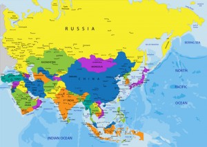
#4. Asia is the largest continent in land area in the world. It is larger than North and South America combined! More people live in Asia (over 4 billion) than the rest of the world’s continents combined (almost 3 billion).
#5. The most common city name in the United States is Franklin, with 31. There are 26 cities in the world with a single letter as its name, two of which are located in America: B, Ohio and Y, Alaska. The original name of Los Angeles was El Pueblo de Nuestra Señora la Reina de los Ángeles del Río de Porciúncula. Translated in English it means The Town of Our Lady the Queen of Angels of the Porciúncula River.
#6. Africa includes 54 countries and over 2000 languages spoken. There are over 500 languages in Nigeria alone! The most widely spoken language is Hausa, which is the first language of over 35 million Africans and another 15 million people in other parts of the world.
#7. Canada contains over 300,000 islands, some of which are available for purchase for less than $1 million. The largest of these islands include Vancouver Island and Newfoundland.
#8. About 90% of the world’s population lives in the Northern Hemisphere. The only Southern Hemisphere nations that contain more than 50 million people are Indonesia and Brazil, at 227 million and 192 million, respectively.
#9. The Amazon rainforest represents more than half of the world’s rainforests and produces more than 20% of the world’s oxygen supply, contains 20% of all of the world’s plants and birds, and 10% of the world’s mammal species. 10% of the forest has been lost to agriculture in the last 50 years, with some forecasting the loss of the entire rainforest by 2030.
#10. The color red appears on the most national flags with 155. White is a close second with 144, and green is a distant third with 97. Purple appears in only six flags. Some national flags are almost identical due to a shared history. For example, blue, white, and red are common color combinations in Slavic nations, and many African nations use red, yellow, and green.
Use these facts as an introduction to a fun Geography Awareness Week lesson that can include a Fun Fact Scavenger Hunt. Ask your students to locate silly and surprising facts about each continent.
What other fun geography facts do you know? Leave them in the comments section! Be sure to visit HelpTeaching.com and try our free geography worksheets.
If you enjoyed this read, you might also like what KidsKonnect has to say. Check out their articles today.
10 Fun Mountain Facts for Geography Awareness Week
- 26 September //
- Posted in Fun Facts //
- Tags : geography, mountains, social studies
- Comments Off on 10 Fun Mountain Facts for Geography Awareness Week

Geography Awareness Week is celebrated every year during the third week of November. The goal of the week is to get people excited about geography and help them learn more about the world around them. Every year, Help Teaching presents fun facts to help you get excited about this special week, and this year is no exception. We have rounded up 10 fun facts about one of the most majestic and awe-inspiring geographical features on Earth – mountains! Keep reading for our mountain facts for Geography Awareness Week!
1) What is a Mountain?
There are no universally agreed upon rules for what makes a mountain a mountain.
It’s generally acknowledged that a mountain is a landform that is taller than the surrounding area and bigger than a hill. Of course, there is also no agreed upon definition of a hill either. This controversy is famously portrayed in the 1995 feature comedy film The Englishman Who Went Up a Hill But Came Down a Mountain starring Hugh Grant.
Because there is not an official definition of a mountain, countries define what a mountain is in different ways. For example, in Ireland and the United Kingdom, only a landform over two thousand feet tall is considered a mountain, while in the United States, a mountain can be thus named as long as it’s over one thousand feet tall. This means that a mountain in one country might be considered a hill in another.
Mountains are found all over the world. Each of the seven continents have its own mountains. Here are some fun facts about the mountains on each of the continents.
2) North America: Oldest Mountains
Many geologists believe the Appalachians are over 480 million years old. It’s thought they were formed during the Ordovician period when the North American tectonic plate crashed into another plate during the creation of the super-continent of Pangaea. The Appalachians may have once been as tall as the Rocky Mountains, but have perhaps been worn down over time.
3) South America: Longest Mountain Range
The Andes extend over 4,300 miles through Venezuela, Ecuador, Peru, Bolivia, Chile, and Argentina. It’s believed the mountains were pushed up when the Nazca and Antarctic plates started slipping under the South American Plate. The highest volcanoes in the world, and the highest mountains outside of Asia, are located in the Andes mountain range.
4) Asia: Highest Mountains
With more than ten mountains over 26,000 feet in height, the Himalayas are the tallest mountains in the world. The biggest jewel in the crown of Himalayan peaks is Mount Everest. With a height of five-and-a-half miles, Everest is the tallest mountain in the world.
But hold on… there is some dispute over whether or not Mount Everest is actually the tallest mountain on the planet. Mountain height is measured by how high the peak of a mountain is above sea level, not how tall the slopes of the mountain are. The base of Mount Everest sits in the Tibetan Plateau, which is more than 13,000 feet above sea level, meaning that the slopes are around 15,000. Denali in Alaska, on the other hand, has a base that is less than 3,000 feet above sea level and slopes that are almost 19,000 feet.
It’s believed the Himalayas are among the world’s youngest mountains formed when the Indian continental plate collided with the Eurasian plate. The Indian plate moves 67mm per year, which means that that the Himalayas are still growing!
5) Africa: Tallest Free-Standing Mountain
Mount Kilimanjaro in Tanzania is a volcano that is not part of any mountain range. The mountain has three distinct volcanic cones, two of which are extinct, but the third is only dormant and could erupt again at some point. It is unclear when Mt. Kilimanjaro last erupted, but it is suspected to have been during the 19th century. Because of its height, Mount Kilimanjaro is one of the only mountains in Africa to have a permanent snowcap.
6) Australia: Smallest Mountain
Not every continent has tall mountains. Mount Wycheproof in Australia is officially the smallest mountain in the world. To most of the world Mount Wycheproof would barely be considered a hill. The mountain measures in at a staggering 486 feet above sea level. You would have to stack up almost sixty Mount Wycheproofs to reach the height of Mount Everest.
7) Europe: Most Photographed Mountain
Though it is impossible to accurately verify, residents of the town of Zermatt, Switzerland claim that the nearby Matterhorn is the most photographed mountain in the world. Even without that designation, the Matterhorn is an extremely popular tourist attraction and its image has become a symbol of Switzerland.
8) Antarctica: Mountains Covered in the Most Snow
Did you know that even Antarctica has mountains? They might not be the highest or the longest mountains in the world, but the Gamburtsev Mountains are the only mountains that are completely covered with snow. No one has actually seen the mountains because they are currently buried under two thousand feet of snow and ice. From 2007 to 2009, scientists used ice penetrating radar to survey mountain range. From their findings it has been determined that the mountains probably are around 6,500 feet tall and resemble the Alps in Europe.
9) The World’s Tallest Mountain: It’s Not What You Think
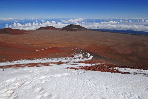
Ok, so every school kid knows that the aforementioned Mount Everest is the tallest mountain on the planet, right? Not so fast… the truth is there is a mountain taller than Everest from base to peak, but it so happens to be mostly underwater! Mauna Kea, a volcano on the big island of Hawaii, is 32,696 feet (6.2 miles), some 3,661 feet taller than Everest. More than half of Mauna Kea’s height is below the surface of the Pacific Ocean, and 2.6 miles of the volcano is above sea level.
10) The Tallest Known Mountain: It’s Out of this World!
We couldn’t resist including this mountain fun fact even though it technically doesn’t qualify as Earth geography. The tallest mountain in the solar system is Olympus Mons on the planet Mars. This otherworldly peak is 13 miles high, making it two and a half times taller than Mount Everest. In fact, there are four other mountains on the Red Planet that surpass Everest. There is even a mountain on the planet Venus that is taller than Everest!
Add to our list of Mountain Facts for Geography Awareness Week
Do you have any fun mountain facts? If so, share them in the comments. For more fun geography facts, check out 10 Fun Facts for Geography Awareness Week and 10 More Fun Facts for Geography Awareness Week, and be sure to check back next year for even more facts!
10 More Fun Facts for Geography Awareness Week
- 10 November //
- Posted in Fun Facts //
- Tags : fun facts, geography, social studies
- Comments Off on 10 More Fun Facts for Geography Awareness Week

It’s that time of year again! That’s right, it’s Geography Awareness Week. The time of year when students clamor for scintillating information about our world and features that make it special. You’ve probably read our first feature, Ten Fun Facts for Geography Awareness Week, and you’ve been waiting for a brand new installment to share with your friends. Well, your wait is finally over. Get a load of these fresh facts about our world.
- The wettest city in America (that is, the city with the most annual rainfall) is Mobile, AL, with an average of 67 inches. The notoriously rainy Pacific Northwest does not appear until 24th on the wettest list, but Olympia, WA is credited with having the most rainy days in the country, averaging 63 per year. The wettest inhabited city in the world is Buenaventira, Colombia, which receives 267” of rain per year!
- Africa is the only continent located in all four hemispheres. It is, therefore, the only continent to have land on the prime meridian and the equator.
- Alaska is clearly the northernmost and westernmost US state, but it’s also the easternmost! The Alaskan Aleutian Islands just barely cross the 180 degree meridian of longitude, placing them in the Eastern Hemisphere.
- China shares its international borders with an incredible 16 nations!
Well, some will argue that it is only 14 bordering nations. China attains its title of Border Nations King only when you include Hong Kong and Macau, “Special Administrative Regions” of China that are not exactly autonomous. If you do not count those two regions as independent nations that border China (and many in Hong Kong do not feel independent), then Russia ties China, as they also have 14 bordering nations. - The largest pyramid in the world is located in…Mexico! The Great Pyramid of Cholula is located in Cholula, Puebla, Mexico and was believed to be dedicated to the god Quetzalcoatl.
- We typically think of deserts as sand covered, barren areas with ridiculously high temperatures. But a desert is actually defined by its (lack of) rainfall amounts. The largest desert on Earth is the Antarctic Desert at 5.5 million square miles. This region averages less than two inches of rainfall per year. The largest hot desert in the world is the Sahara Desert at 3.1 million square miles.
- According to the most recent US census, 192 different languages are spoken in New York City, making it the most linguistically diverse city in the country. New York barely beat out Los Angeles, who came in at 185 languages. The title of most languages spoken in one country belongs to Papua New Guinea with 820! The island has been inhabited for 40,000 years, so many languages have evolved and differentiated themselves from other. Also, Papua New Guinea has many natural barriers, leaving its people very fragmented. Cultural diffusion is minimal and many of these tiny groups have retained their own languages.
- Mount Everest is the world’s tallest mountain…when measured above sea level. When measured from the sea floor, Mauna Kea in Hawaii measures at over 32,000 feet, making it over 3,000 feet higher than Everest. Mauna Kea is less than 14,000 feet high when measured from above sea level.

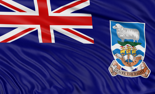
- The Falkland Islands house 500,000 sheep and only 3,000 people. There are numerous countries whose sheep population outnumbers the human population including New Zealand,Mongolia, and Australia.

- If you don’t like your neighbors, move to Mongolia. It is the least densely populated country in the world with four people per square mile. Monaco is the most densely populated country in the world at 49,236 people per square mile. Though, some would argue that Monaco’s reign as most densely populated country is unfair. The nebulous nature of the aforementioned Macau puts Monaco’s title in danger, as the “Special Administrative Region” of China has a population density of 55,301 per square mile.

Leave any fun geography facts that you discover in the comments section. We’ll be sure to have our third annual Geography Extravaganza next year.